« August 2007 | Main | October 2007 »

September 2007 Archives

September 6, 2007

Weekend Events - September 8th & 9th

A few events of note to WPAers this coming weekend:

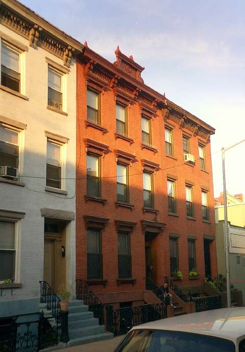
Brownstoner's Salvage Fest 2007
Washington & Greene
Saturday, 8 September
10 am to 4 pm
On Saturday, September 8 (September 9 if it's raining), all the architectural salvage dealers in the New York City area will be coming together in the school yard of PS 11 in Clinton Hill (at Washington and Greene Avenues) from 10 am to 4 pm to serve up a delicious array of old building parts, fixtures and lighting. Who will be there? Williamsburg's own Moon River Chattel, Chelsea's (by way of Scranton) Olde Good Things, Harlem's Demolition Depot, Astoria's Build It Green, Clinton Hill's Eddie's Salvage, and Bed Stuy's Reclaimed Home; Philly-based Old Soul Architectural Salvage and Virginia-based Architectural Salvage News will also be in the house. In addition, Build It Green will have a drop-off station for recycling any odd building materials you may have lying around so bring over that box of tiles that's been taking up space in your basement since you finished you bathroom renovation five years ago! ... Admission is free—as are Brownstoner bumper stickers for the first 100 people to show up.
City Reliquary's 4th Annual Tribute to Our City
Havemeyer, between Grand and Hope
Saturday, 8 September
12 am to 6 pm
A neighborhood pot-luck picnic in the streets complete with live music, games, raffle prizes, entertainment, free food and goodwill all day long! Please come out to join us. We will be joined by our friends from, Brooklyn Historical Society, Brooklyn Public Library, Lower East Side Tenament Museum, Coney Island Museum, The Gowanus Wildcats Drill Team with singer Renee Flowers, a performance by Kay Turner of Brooklyn Arts Council, live local bands, and more. BBQ's will be grilling all day and we encourage all potluck picnicers to come out and join us! Come out to meet your neighbors, appreciate our city, and show your support for your hometown museum, The City Reliquary!

September 21, 2007

Fillmore Place Historic District

23_fillmore.jpg
23 and 25 Fillmore Place (photo: WPA)


One of the things that has been keeping us busy of late is Fillmore Place. For those of who don't know it, Fillmore Place is a one-block long street running between Driggs and Roebling, parallel and between Metropolitan and Grand. Turning the corner on Fillmore is like walking into a another world - the narrow street is lined on both sides with 1850s brick row houses, all constructed as a single development. Fillmore Place was the brainchild of Alfred Clock and Ephraim Miller, a pair of Williamsburgh merchants and real estate developers who bought up property on the block in the late 1840s and opened Fillmore Place at their own expense.

Author Henry Miller spent his early childhood at 662 Driggs Avenue, his grandfather's house, at the head of Fillmore Place. In Tropic of Capricorn he recalled Fillmore Place as "the most enchanting street I have ever seen in all my life... it was the ideal street...". Miller, who also lived for a time in Bushwick, wrote frequently about Fillmore Place and the surrounding neighborhood, recalling a saloon at the corner of Driggs & Fillmore, his kindergarten at the opposite end of Fillmore, as well as the fishmonger on Grand Street (who lived at 18 Fillmore Place).

Clock & Miller constructed about 24 rowhouses on Fillmore Place, Driggs Avenue (then called Fifth Street) and Roebling (Sixth) Street. Twenty one of those rowhouses survive today, most of them quite intact. The three-story buildings are simple in design, decorated with a variety of brownstone details and wood cornices typical of their time.

In 2005, Fillmore Place was nominated by the Municipal Art Society as a potential New York City Historic District. Today, WPA is submitting an in-depth historical analysis of the block and the surrounding area to the Landmarks Preservation Commission. We are requesting that Landmarks move now to designate Fillmore Place as Williamsburg's first Historic District. The proposed Fillmore Historic District includes the 21 surviving Clock & Miller buildings, as well as the Henry Miller house and three other mid-19th-century rowhouses on Driggs. Together, these buildings represent a significant part of Williamsburgh's first real estate boom (yes, its happened before), a rare a surviving example of a large-scale pre-Civil War residential development.

September 23, 2007

How Fillmore Place Came To Be

Fillmore Place was a very late addition to the Williamsburg street grid. When the Village of Williamsburgh was laid out in the early 1800s, Fillmore Place didn't exist. The following is an excerpt from WPA's Fillmore Place Historic District nomination, describing how this one-block long street came to be.


The area of Brooklyn that is today called Williamsburg (without an “h”) was, together with Greenpoint, in Colonial times part of the town of Bushwick. One of the five original Colonial-era towns of Kings County (together with Brooklyn, Flatbush, New Utrecht and Gravesend), Bushwick was first settled by French émigrés. The center of the Town of Bushwick, such as it was, was located about a mile east of Fillmore Place, near the intersection of what is now Metropolitan Avenue and Bushwick Avenue.

Throughout the 17th and 18th centuries, the portion of Bushwick that was to become Williamsburg was sparsely populated. A few mansions and summer residences dotted the “Strand” – a road that ran along the edge of the East River from Wallabout bay north to Bushwick inlet (roughly where Kent Avenue is today). Inland, were the farms of various families, including Meseroles, Woodhulls, Morrells, Wyckoffs and Dunhams.

In 1800, Richard Woodhull established a ferry service from Bushwick to Rivington Street in Manhattan. Woodhull’s ferry departed from the foot of the Williamsburgh & Jamaica Turnpike Road, which ran along of the course of today’s Metropolitan Avenue. Within a few years, a second ferry service was established by Thomas Morrell from the foot of Grand Street to Roosevelt Street in Manhattan.

In 1802, Woodhull bought much of the land between the Brooklyn border (at today’s Division Avenue) and the Bushwick Inlet. It was on this tract of land, bordered on the east by Bushwick Creek (roughly where Union Avenue runs today), that Woodhull proposed to establish a new village. In 1802, Woodhull hired Colonel Jonathan Williams to lay out the streets and avenues of his proposed development. It was in honor of Colonel Williams that the Village of Williamsburgh (with an “h”) got its name.

The original plan of the Village of Williamsburgh consisted of a rather confusing array of numbered streets running north to south (with First Street (now Kent Avenue) at the river and Eleventh Street (now Union Street) to the east) and numbered streets running east to west. Grand Street served as the dividing line between north and south, with the east/west street numbers increasing in each direction (North 1st, North 2nd, etc. and South 1st, South 2nd, etc.). Williams’ plan retained a few thoroughfares that existed prior to the establishment of Williamsburgh, most notably the Jamaica Farm Road/Turnpike (which was renamed North 2nd Street in the Williams plan - it did not become Metropolitan Avenue until the early 20th Century).

Because the Jamaica Turnpike did not follow a straight path to the east, North 2nd Street carved an eccentric line through Williams’ otherwise rational grid. The curve of the Turnpike began between Fourth Street and Fifth Street (Bedford Avenue and Driggs Avenue today). This resulted in odd sized blocks between there and the Williamsburgh and Bushwick border.

1846_Fillmore.jpg
Williamsburgh, 1846, prior to opening of Fillmore Place. North 2nd Street (now
Metropolitan, top) and Grand Street (bottom) are highlighted in green. Source:
NYPL (Richard Butt, Map of the City of Brooklyn, photoedited).

Fillmore Place was not part of the original Village of Williamsburgh, as laid out by Colonel Williams in 1802. North 1st Street always terminated at Fifth Street (Driggs Avenue), while Hope Street to the east started at Sixth Street (Roebling Street) and continued east to the village border at Eleventh Street (Union Avenue).1 The block that was bounded by North 2nd Street (Metropolitan Avenue) and Grand Street, Fifth Street (Driggs Avenue) and Sixth Street (Roebling Street), was thus very deep in its north/south dimensions.

The earliest reference to Fillmore Place comes in an 1852 New York Times article, which notes “Messrs. Clock and Miller have commenced opening, at their own expense, a new street, from South and Fifth-stret [sic], between Grand and North First. It will be built up with magnificent dwellings”. The earliest reference to name the street located to date is an 1856 assessment list in the Brooklyn Daily Eagle; this refers to it as Fillmore Street.

In the same year that Fillmore Place was established, Williamsburgh was declared a city in its own right. In the preceding decades, Williamsburgh had grown from a small village to a town separate from Bushwick, and finally to a city. Along the way, the population of Williamsburgh had grown from 934 in 1820 to 1,117 in 1830 to 5,094 in 1840. By the time it was declared a city in 1852, the population of Williamsburgh was estimated at 38,000, making it one of the larger cities in New York State.

Williamsburgh’s independence was short lived, however. By 1854, the cities of Brooklyn and Williamsburgh were negotiating the annexation of the latter by the former. In 1855, the City of Brooklyn officially annexed the City of Williamsburgh along with the Towns of Bushwick and Greenpoint (it was at this point, for reasons unknown, that Williamsburgh officially lost its “h”). By that point, Fillmore Place was a part of the Williamsburg street grid, and most of the buildings that you see on the block today were constructed and occupied.

1. Hope Street went by a few different names early on. At first, it appears to have been part of Powers Street. In the 1840s, it was labeled North Street on one map, and in 1850, it was labeled North 1st Street.

September 25, 2007

Domino = Landmark

Domino Sugar Processing House - A NYC Landmark!
Domino Sugar Refinery, Processing House, the newest City landmark
Photo: michaelsharon

WPA is pleased to announce that the Landmarks Preservation Commission has designated the main refinery building of the Domino Sugar refinery a landmark. Once again, the Landmarks Commission has shown tremendous resolve in recognizing the importance of Brooklyn's industrial heritage. The Mayor's office also deserves praise for recognizing that Williamsburg's industrial past deserves has a place in its bright new future.

The designation of the refinery is great news. It is something that WPA, its members and its supporters have worked very hard to make happen. We are excited that the Domino Sugar Refinery will actually be a part of the New Domino, and not just another branding opportunity.

If you've been following along, you know that the designation does not include a number of other significant buildings on the Domino site that WPA and others have advocated for. It is unfortunate that the Landmarks Commissioners never had an opportunity to review the other buildings on the site. Despite the developer's claims to the contrary, the remainder of the site has been determined historically significant and eligible for the National Register of Historic Places. WPA will continue to work for more preservation at the site, and in particular for preservation that we feel is compatible with the larger community goals for the site, including affordable housing and open space. We welcome the opportunity to work with the developer as a consulting party on the ongoing public review of the project.

The designation of the Domino refinery is still subject to the approval of the City Council (and we know what can happen there). So until then, we will leave our question mark in place.

September 26, 2007

Domino Designation: Press

one domino.jpg
Domino Sugar, main refinery building.

In the papers:
Times
NY Post
amNY/Newsday

"Domino really became a symbol to us," said local activist Mikki Halpin, who organized a benefit concert over the summer to raise money to preserve the complex. "It would be great if we could save this one little piece of waterfront, have one place where the paint is still peeling."
"What drew people originally to the area was the human scale of the neighborhood," said industrial archeologist Mary Habstritt. "It is nothing like what the developers are planning."
Sun
Staten Island Advance
AP (via Houston Chronicle)

On the air:
WNYC
NY1
Fox News

On the interweb:
Gothamist
Brownstoner
Curbed
and Curbed

Last but not least, in dessert land:
Cakehead

And GowanusLounge has a very spot-on analysis of what it all means (and, significantly, what it doesn't mean).

LPC's Industrial Legacy

184_cyan.jpg
Austin, Nichols & Co. Warehouse
Designated by LPC, 2005

With the designation of the Domino Sugar Refinery Processing House, the Landmarks Commission has proven once again that it gets industrial heritage. Sure, they could have gotten a lot more, but its worth highlighting the fact that this is the fourth major industrial site in North Brooklyn to be designated in the past few years. And to the great chagrin of the beauty pageant promoters who believe that landmarking is only about "pretty" buildings, not all of these buildings are pretty. But they are all significant, locally and to the city (some are nationally significant).

Here's the rundown:

1. Hecla Ironworks administration building [pdf link] (designated 2004)
2. Austin Nichols & Co. Warehouse (designated 2005)
3. Domino Sugar Refinery, Processing House (designated 2007)
4. Eberhard Faber Pencil Factory Historic District (designated soon?)

Add to that the recent calendaring of DUMBO, and LPC Chair Robert Tierney is right to tout his commission's role in designating industrial properties. There may be other Hecla, Domino and Eberhard buildings that are not landmarks and should be, but lets give credit where its due.

Landmarks has also been busy with some of North Brooklyn's non-industrial sites of late. Witness the designation of the Williamsburg Houses (2003), the original Smith-Gray Building [pdf link] (2005), and the McCarren Park Pool (2007).

And lest Mr. Tierney rest on his laurels, we will point out that there are a lot more highly significant (dare we say beautiful) industrial buildings out there to designate. Not to mention a host of other buildings in our (until recently) neglected corner of Brooklyn. And Williamsburg is still without a single historic district (hopefully not for long).

About September 2007

This page contains all entries posted to WGPA in September 2007. They are listed from oldest to newest.

August 2007 is the previous archive.

October 2007 is the next archive.

Many more can be found on the main index page or by looking through the archives.

Creative Commons License
This weblog is licensed under a Creative Commons License.